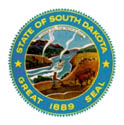
 STATE SEAL |
 |
 STATE FLAG |
 STATE SEAL |
 |
 STATE FLAG |
 |
NICK NAME | The Sunshine State; Coyote State | |
 |
CAPITAL CITY | Pierre | |
 |
LARGEST CITY | Sioux Falls | |
 |
SECOND LARGEST CITY | Rapid City | |
 |
LARGEST COUNTY | Minnehaha | |
 |
AREA | 77,121 sq. miles; 75,898 sq. miles land, 1,224 sq. miles water. (17th state) | |
 |
HIGHEST ELEVATION | 7,242 ft., Harney Peak (Pennington County) | |
 |
LOWEST POINT | 962 ft., Big Stone Lake (Roberts County) | |
 |
ABBREVIATION | SD (postal); S.D. (traditional) | |
 |
AREA CODE(S) | 605 | |
 |
TIME ZONE | Central and Mountain (Western counties) | |
 |
PART OF REGION | Plains States; Midwest | |
 |
ADMISSION DATE | November 2, 1889 (40h State) | |
 |
LOCATION | In the north central United States, bordering Nebraska, Wyoming, Montana, North Dakota, Minnesota, and Iowa. | |
 |
NAME ORIGIN | For the Dakota (Sioux) Indian confederation, in whose language the word means "allies," referring to the friendly compact that joined seven smaller tribes. The name was originally applied to the entire Dakota Territory, which was divided into North and South in 1889. | |
 |
STATE ANIMAL | Coyote (Canis Latrans) | |
 |
STATE BIRD | Ring-Necked Pheasant (Phasianus Colchicus) | |
 |
STATE DRINK | Milk | |
 |
STATE FISH | Walleye (Stizostedion Vitreum) | |
 |
STATE FLOWER | American Pasque (Pulsatilla Hisutissima) | |
 |
STATE FOSSIL | ||
 |
STATE GRASS | Western Wheatgrass (Agropyron Smithii) | |
 |
STATE INSECT | Honey Bee (Apis Mellifera | |
 |
STATE MINERAL | Rose Quartz | |
 |
STATE SONG | "Hail, South Dakota" | |
 |
STATE SPORT | ||
 |
STATE STONE | Fairburn Agate | |
 |
STATE TREE | Black Hills Spruce (Picea Glauca Densata) | |
 |
STATE MOTTO | Under God the People Rule |


 |
US Facts Menu |
Other US States |

